Rani Jhari Viewpoint: A Complete Guide to Karnataka's Hidden Gem in the Western Ghats
Rani Jhari is a scenic viewpoint and waterfall near Kalasa, Chikmagalur — 33 km from Astagiri Homestay (about 1 hr 20 mins by car). Easy to visit with a short walk from parking, no trekking experience needed. Best visited August to December when the falls are flowing.
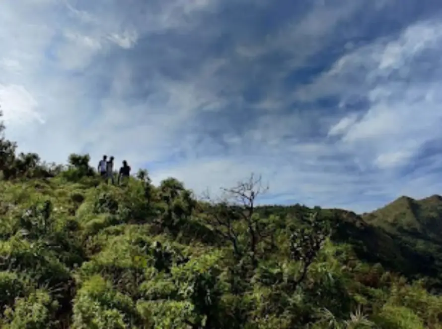
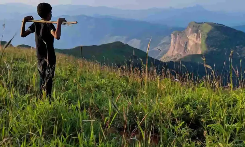
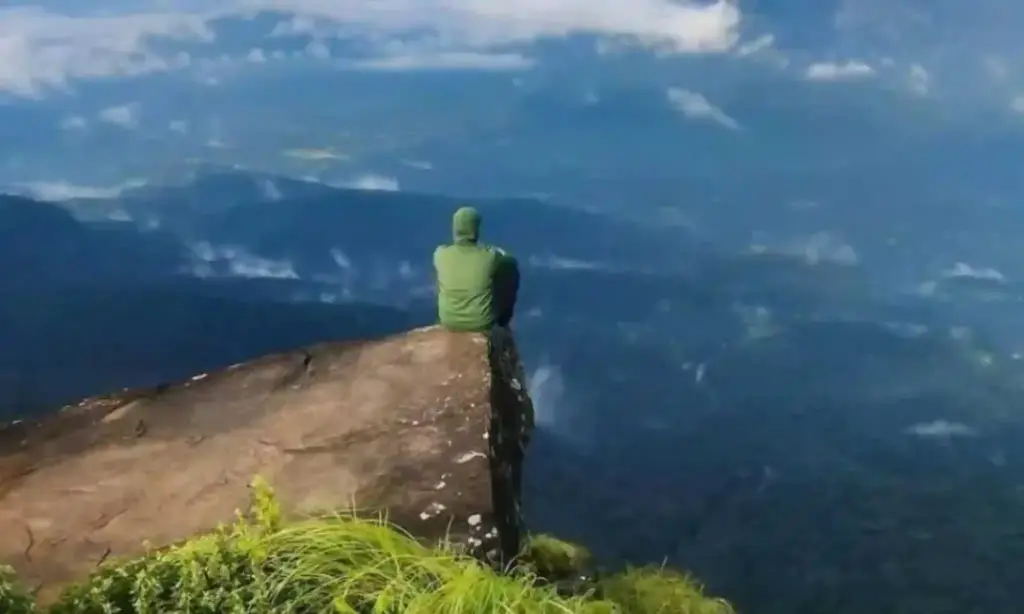
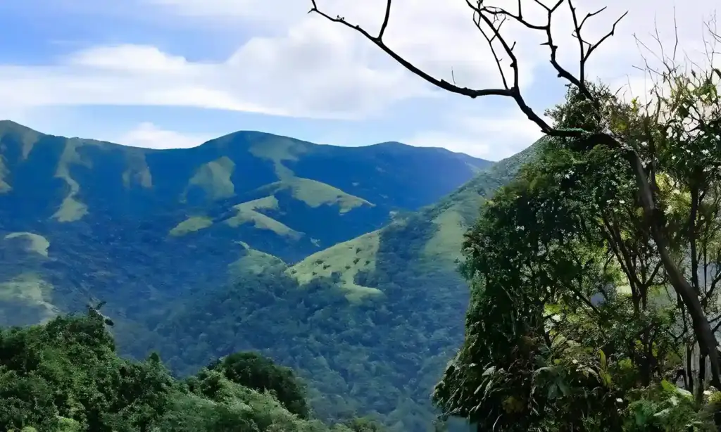
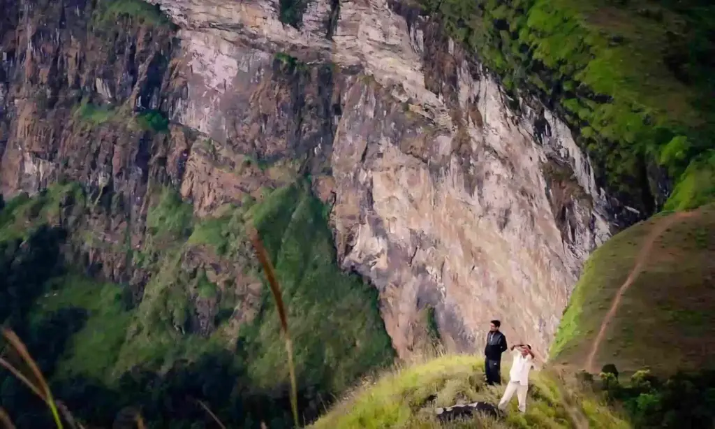
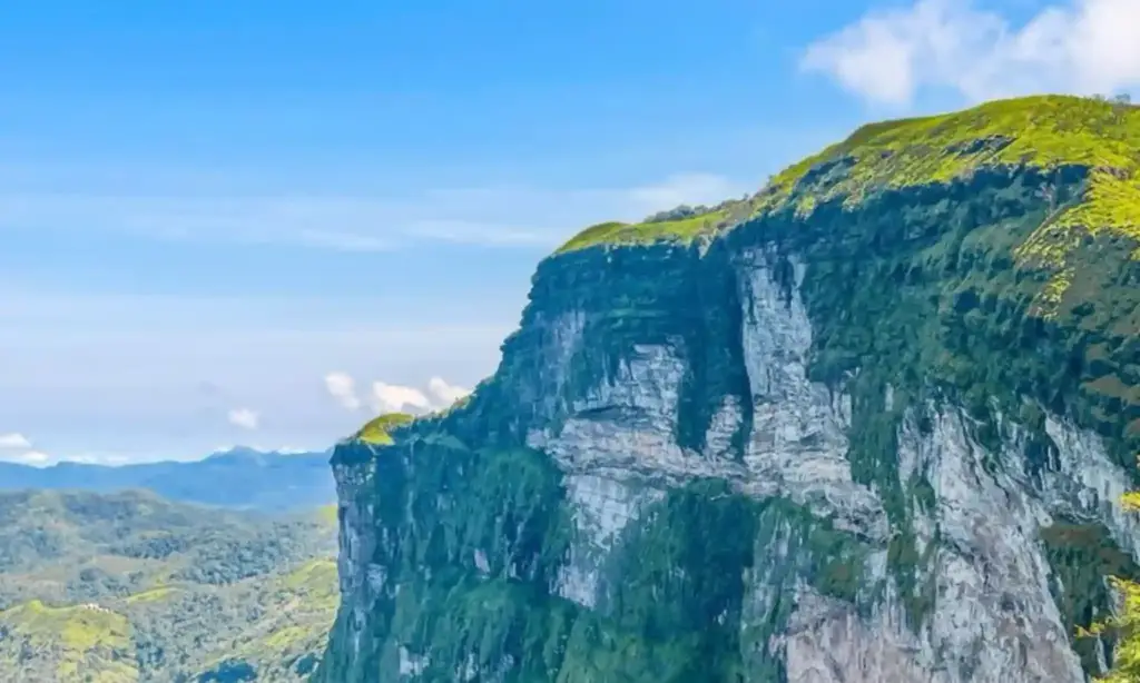
Rani Jhari Viewpoint is one of those quiet, lesser-known places in Chikmagalur that takes your breath away the moment you reach the edge. Sitting on a cliff in the Western Ghats, it gives you wide, sweeping views of the Kudremukh range, deep green valleys, and rolling grasslands. If you love offbeat travel, photography, or short treks with a big payoff, this is a place worth adding to your list.
In this guide, we’ve put together everything you need to plan your visit to Rani Jhari, including how to reach it, what to expect, what the name means, and a few tips most blogs don’t mention.
What is Rani Jhari Viewpoint ?
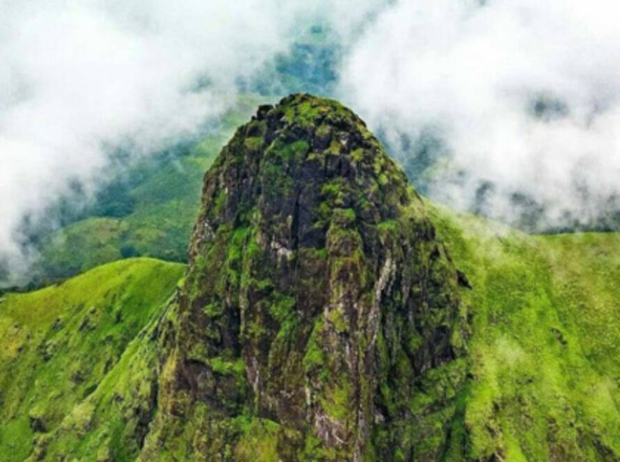
Rani Jhari is a cliff-edge viewpoint located in Durgada Halli village, near Kalasa, in the Chikmagalur district of Karnataka. It sits right next to the famous Ballalarayana Durga fort and is part of the well-known Bandaje Trek, which has two main viewpoints:
- Rani Jhari Viewpoint – the cliff edge with panoramic Western Ghats views
- Ballalarayana Durga Fort – an old Hoysala-era hill fort
Both are usually visited together, and the area is loved by trekkers, photographers, and nature lovers.
Meaning of the Name "Rani Jhari"
The name has a story behind it, and locals share it with anyone who asks.
“Rani” means Queen in Kannada, and “Jhari” comes from the word for fall or leap. So Rani Jhari roughly translates to “Queen’s Fall” or “Queen’s Leap.”
According to local legend, when Tipu Sultan of Mysore attacked the Ballalarayana Durga fort, the queen — said to be Rani Padmini Devi — chose to leap from this cliff rather than surrender. The cliff has carried her name ever since. Some versions of the story say she slipped accidentally, while others believe she jumped to escape capture. Either way, the place feels heavy with history when you stand at the edge.
Where is Rani Jhari Located?
Rani Jhari is in Durgada Halli village, near Kalasa town, in Chikmagalur district. It is part of the Western Ghats and shares its surroundings with the Kudremukh National Park.
Distance from Major Cities
Here are the approximate driving distances to help you plan your trip:
| From | Distance | Approximate Drive Time |
| Bangalore | 280–290 km | 6–7 hours |
| Mysore | 225–235 km | 5.5–6.5 hours |
| Mangalore | 120–130 km | 3–3.5 hours |
| Chikmagalur | 65–70 km | 2 hours |
| Mudigere | 35–40 km | 1.5 hours |
| Kalasa | 21 km | 45 minutes |
Distance from Astagiri Homestay
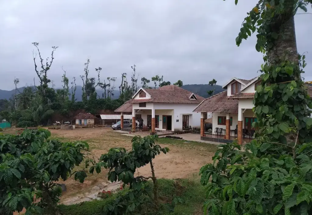
If you are staying with us at Astagiri Homestay (near Kalabhairaveshwara Temple, Kotrakere village, Banakal, Mudigere taluk), you are in the perfect spot. The Rani Jhari viewpoint parking is just a short drive away, and you can easily plan it as a half-day or full-day outing. From Astagiri, the Kalabhairaveshwara Temple – which is the trek base – is only around 4 km away, making it one of the closest stays to Rani Jhari. Astagiri Homestay offers a warm, authentic Malnad experience — home-cooked local cuisine, comfortable rooms, and the kind of peaceful surroundings that make you want to stay an extra day. Waking up here means waking up to birdsong, fresh mountain air, and a short, scenic drive to one of Chikmagalur’s most beautiful spiritual destinations. Whether you’re traveling solo, as a couple, or with family, booking Astagiri Homestay lets you skip the long early-morning drive from Chikmagalur town.
How to Reach Rani Jhari from the Parking Point
Once you reach the Rani Jhari Edge Point Parking Spot, you have three ways to get to the viewpoint:
- By Jeep – Local jeeps are available for hire and are the most popular choice. The road from the parking is rough, narrow, and unpaved, so a 4×4 jeep handles it best.
- By Bike – If you are on a sturdy two-wheeler and you are confident on rough roads, you can ride up. Regular city bikes will struggle, so go only if you are comfortable.
- On Foot – Walking is the most rewarding option. The trail is short and scenic, passing through coffee estates, grasslands, and forest patches. The walk to the viewpoint is around 1.5 km and takes 30 to 45 minutes.
If you have time, we always suggest walking. The forest sounds, the cool breeze, and the slow buildup to the cliff edge make the experience much more memorable.
Entry Fee and Timings
- Entry fee: Free
- Timings: 6:00 AM to 6:00 PM
- Permits: No special permit is needed for the viewpoint itself. (However, if you are doing the full Bandaje Falls trek, you may need a forest department permit through the Karnataka Eco-Tourism website.)
We recommend reaching as early as possible, ideally just after sunrise, to enjoy the cool weather and clear views before clouds roll in.
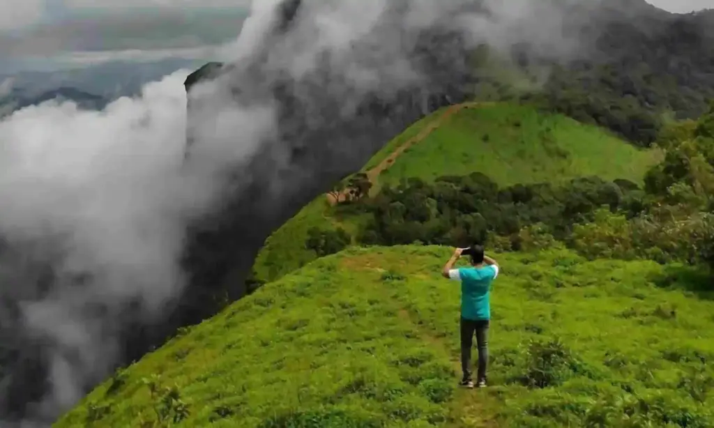
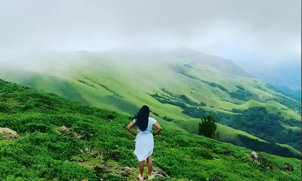
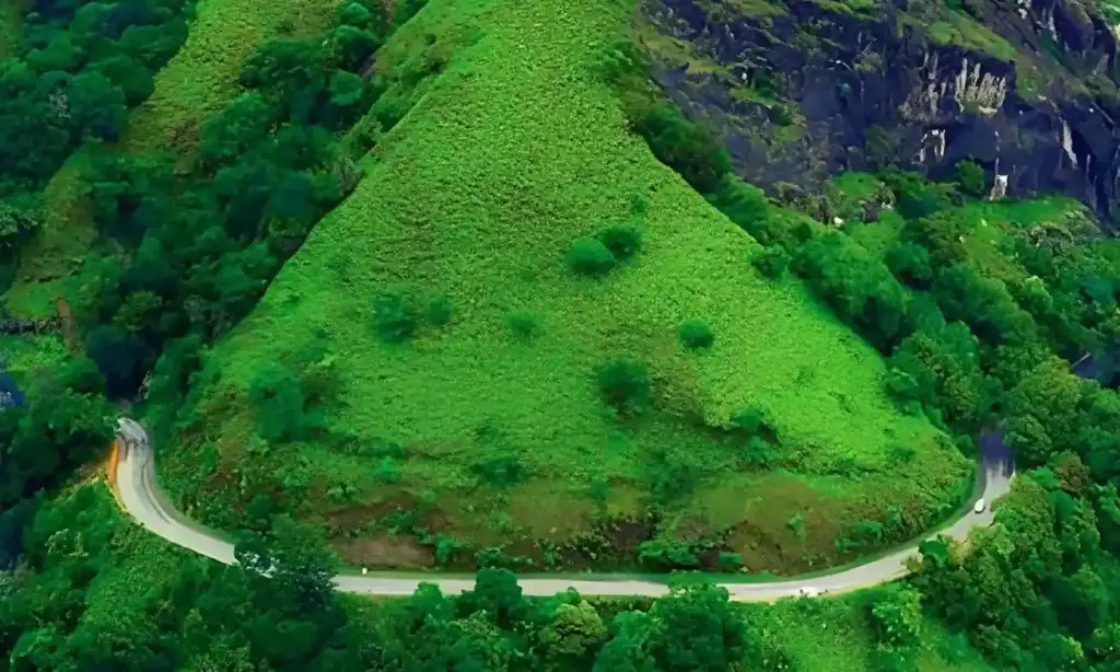
What Can You See from Rani Jhari Viewpoint?
This is the part that surprises most first-time visitors. The view is huge, open, and almost cinematic. From the edge, you can see:
- The Kudremukh mountain range stretching across the horizon
- Ballalarayana Durga Fort sitting proudly on the next hilltop
- Endless green valleys and Shola grasslands rolling down below
- Layers of misty mountains (especially beautiful in monsoon and post-monsoon months)
- Coffee, tea, pepper, and rubber estates dotting the slopes
- Spectacular sunsets when the sky turns orange and pink behind the hills
- Wildlife and birds, including Malabar Whistling Thrush, Great Indian Hornbill, jungle fowl, and sometimes deer in the distance
Standing at the edge feels like standing on the balcony of the Western Ghats. On a clear day, the view goes on for miles.
The Bandaje Trek Connection
Rani Jhari is the starting point of the popular Bandaje Trek (also called Ballalarayana Durga – Bandaje Arbi Falls Trek). The trek includes:
- Rani Jhari Viewpoint – the first big view of the day
- Ballalarayana Durga Fort – an old Hoysala fort with ruins and a hilltop flag
- Bandaje Arbi Falls – a 200+ feet waterfall (only for those doing the full trek)
If you are short on time or travelling with family, you can simply visit Rani Jhari and the fort and head back. The full trek to Bandaje Falls is around 15 km round trip and takes 7 to 8 hours, so plan accordingly.
Why Photographers Love Rani Jhari
If you carry a camera, drone, or even just your phone, Rani Jhari is a dream.
- Wide, unobstructed cliff edge for that classic “edge of the world” shot
- Golden hour light that hits the valleys beautifully at sunrise and sunset
- Misty mornings and cloud play during monsoon and just after
- Layered mountain ranges that give natural depth to landscape photos
- Star photography opportunities thanks to low light pollution
Pro tip: Carry a wide-angle lens if you have one. The view is too big to fit in a standard frame.
Best Time to Visit Rani Jhari
- November to February: The best overall time. Clear skies, cool weather, and great views.
- March to May: Warmer, but still good for views. Mornings are pleasant.
- June to September (Monsoon): Magical and misty, but trails can be slippery and leeches are common. Views may be cloud-covered.
October: A sweet spot — green landscapes from the monsoon plus clearer days.
A Few Unique Things You Might Have Missed
Most blogs cover the basics, so here are some extra details that often get left out:
- The cliff has no railing, so be very careful at the edge. Don’t walk backwards while clicking pictures, and keep children close at all times.
- Mobile network is patchy. Download offline maps before you head up, and inform someone at your homestay about your plans.
- The wind can be strong, especially during monsoon, and can literally push you a step or two. Wear a cap with a strap or a buff to protect your ears.
- Carry your own water and snacks. There are no shops, food stalls, or water sources at the viewpoint.
- Leeches love this area in monsoon. Carry salt or a small bottle of Dettol, wear long socks, and slip your pants into them.
- It is a “Leave No Trace” zone in spirit. Please carry your trash back. The local community works hard to keep this place clean, and the more we respect it, the longer it stays beautiful.
- Pair it with Devaramane Viewpoint for a perfect sunset day. Devaramane is a short drive from Astagiri Homestay and has a calmer vibe.
Stargazing is incredible here on clear nights. If you are staying nearby, ask your homestay about a short evening visit (within safe hours).
What to Carry
A small checklist for your Rani Jhari visit:
- Comfortable trekking shoes with good grip
- A light jacket (mornings can be chilly)
- Water bottle and light snacks
- Cap, sunglasses, and sunscreen
- Camera or phone with a power bank
- A small backpack
- Trash bag to bring back any waste
- Salt or anti-leech spray (for monsoon visits)
Frequently Asked Questions (FAQs)
Yes, it is open to the public from 6:00 AM to 6:00 PM, and entry is free.
No permit is needed for the viewpoint. A forest department permit is only required if you are doing the full Bandaje Falls trek beyond the fort
A regular car cannot manage the rough road beyond the parking spot. Only 4×4 jeeps and bikes can go further. Most visitors park at the Rani Jhari Edge Point Parking and either hire a jeep or walk up.
From the parking, the walk to the viewpoint is about 1.5 km and takes 30 to 45 minutes one way, depending on your pace.
The trail is short and easy, so most age groups can manage it. However, the cliff edge has no railing, so close supervision is important.
No, there are no shops or stalls. Carry your own food and water, or ask Astagiri Homestay to pack you a meal.
Network is weak to non-existent. Download offline maps and inform your homestay before heading out.
Yes, both are part of the same trail and most visitors cover them together in a half-day outing.
es, there is a designated parking area called “Rani Jhari Edge Point Parking Spot,” easily found on Google Maps.
Yes, but views are often blocked by clouds and the trail can be slippery. Some travellers love the misty experience, while others prefer
clearer post-monsoon months.
Conclusion:
Rani Jhari is the kind of place that stays with you long after you leave. It blends nature, legend, and adventure into one quiet, beautiful spot. Whether you are a serious trekker, a casual traveller, or someone who just wants to sit on a cliff and watch the clouds drift by, Rani Jhari delivers.
If you are planning a visit, Astagiri Homestay is one of the closest places to base yourself. You get warm Malnad food, clean rooms, peaceful surroundings, and easy access to Rani Jhari, Ballalarayana Durga Fort, Devaramane Viewpoint, and more.
Pack light, start early, respect the place, and let the Western Ghats do the rest.